45378 ZIP Code, Verona, OH
Preble County · Montgomery County · 0.3 sq mi of land · 210 data points on this page
Where is 45378?
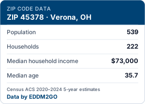
45378 is a ZIP code in Verona, Ohio — mostly in Preble County (80% of its land), with smaller parts in Montgomery County. It covers 0.3 square miles of land. The closest ZIP codes are 45338, 45354 and 45309. 539 people live here in 222 households, fewer than in most Ohio ZIP codes. At about 1,761 people per square mile it has suburban density, and most homes are owner-occupied (87%). Median household income is $73,000, close to the Ohio median of $71,389.
- Mailing city
- Verona, OH
- County
- Preble County
- Land area
- 0.3 sq mi
- Population
- 539
- Median household income
- $73,000
Overview
Carrier routes in 45378
Every USPS carrier route in 45378 with current mailbox counts and an estimated household profile for each. EDDM mails by the route, so this is the level you choose at. How carrier routes work
People
Who lives in 45378: age, household makeup and background.
Population pyramid
Share of all residents by age and sex · hover a bar for the comparison area
| Age | Men | Women |
|---|---|---|
| <5 | 21 | 20 |
| 5–9 | 19 | 4 |
| 10–14 | 21 | 2 |
| 15–19 | 29 | 6 |
| 20–24 | 32 | 23 |
| 25–29 | 10 | 21 |
| 30–34 | 36 | 15 |
| 35–39 | 29 | 19 |
| 40–44 | 9 | 10 |
| 45–49 | 5 | 22 |
| 50–54 | 34 | 6 |
| 55–59 | 10 | 20 |
| 60–64 | 11 | 19 |
| 65–69 | 10 | 15 |
| 70–74 | 5 | 9 |
| 75–79 | 1 | 23 |
| 80–84 | 19 | 1 |
| 85+ | 0 | 3 |
Age
% of all residents · largest group: 25–34 (15.2%)
| Age | ZIP 45378 | Ohio | U.S. |
|---|---|---|---|
| <10 | 11.9% | 11.7% | 11.6% |
| 10–19 | 10.8% | 12.8% | 13.0% |
| 20–24 | 10.2% | 6.3% | 6.5% |
| 25–34 | 15.2% | 13.2% | 13.7% |
| 35–44 | 12.4% | 12.5% | 13.2% |
| 45–54 | 12.4% | 12.0% | 12.2% |
| 55–64 | 11.2% | 13.2% | 12.7% |
| 65–74 | 7.2% | 10.9% | 10.2% |
| 75+ | 8.8% | 7.3% | 7.1% |
Household type
% of households · largest group: Married couple (50.9%)
| Household type | ZIP 45378 | Ohio | U.S. |
|---|---|---|---|
| Married couple | 50.9% | 44.4% | 46.9% |
| Unmarried couple | 5.4% | 7.8% | 7.2% |
| Woman, no partner | 26.1% | 28.4% | 27.5% |
| Man, no partner | 17.6% | 19.4% | 18.4% |
Race & ethnicity
% of all residents · largest group: White (95.7%)
| Race & ethnicity | ZIP 45378 | Ohio | U.S. |
|---|---|---|---|
| Hispanic or Latino | 0.9% | 4.8% | 20.1% |
| White | 95.7% | 75.8% | 56.9% |
| Black | 0.7% | 12.0% | 11.8% |
| Asian | 0.0% | 2.5% | 5.8% |
| Multiracial | 2.4% | 4.3% | 4.2% |
| Other | 0.2% | 0.5% | 1.2% |
Households at a glance
Tick = OhioTick = U.S.
How it has changed
Three non-overlapping ACS 5-year periods (dollars as published, not inflation-adjusted; boundaries changed in 2020)
Income & spending power
Household income, benefits and economic security.
Household income
% of households · largest group: $100–150K (26.1%)
| Household income | ZIP 45378 | Ohio | U.S. |
|---|---|---|---|
| <$10K | 2.3% | 5.2% | 5.1% |
| $10–15K | 0.5% | 4.0% | 3.5% |
| $15–25K | 9.0% | 7.1% | 6.4% |
| $25–35K | 2.7% | 7.5% | 6.7% |
| $35–50K | 14.4% | 11.6% | 10.1% |
| $50–75K | 23.0% | 16.9% | 15.5% |
| $75–100K | 16.2% | 13.1% | 12.6% |
| $100–150K | 26.1% | 17.1% | 17.4% |
| $150–200K | 5.9% | 8.3% | 9.5% |
| $200K+ | 0.0% | 9.1% | 13.2% |
Income facts
Tick = OhioTick = U.S.
Housing
Who owns, what they live in, and what it costs.
Tenure
% of housing units · largest group: Owned, with mortgage (49.6%)
| Tenure | ZIP 45378 | Ohio | U.S. |
|---|---|---|---|
| Owned, with mortgage | 49.6% | 38.5% | 35.9% |
| Owned outright | 33.3% | 23.8% | 22.9% |
| Rented | 11.7% | 29.7% | 31.0% |
| Vacant | 5.4% | 8.0% | 10.2% |
Type of building
% of housing units · largest group: Detached house (95.7%)
| Type of building | ZIP 45378 | Ohio | U.S. |
|---|---|---|---|
| Detached house | 95.7% | 68.8% | 61.3% |
| Townhome | 3.0% | 4.9% | 6.3% |
| 2–4 units | 0.0% | 7.9% | 7.7% |
| 5–19 units | 0.0% | 8.4% | 8.8% |
| 20+ units | 0.0% | 6.5% | 10.3% |
| Mobile / other | 1.3% | 3.5% | 5.7% |
Home value
% of owner-occupied homes · largest group: $50–100K (27.8%)
| Home value | ZIP 45378 | Ohio | U.S. |
|---|---|---|---|
| <$50K | 8.2% | 6.3% | 5.3% |
| $50–100K | 27.8% | 10.0% | 6.3% |
| $100–150K | 18.0% | 13.3% | 7.0% |
| $150–200K | 26.3% | 16.3% | 9.1% |
| $200–300K | 19.6% | 23.3% | 17.8% |
| $300–500K | 0.0% | 21.8% | 26.7% |
| $500K–1M | 0.0% | 7.7% | 20.7% |
| $1M+ | 0.0% | 1.2% | 7.0% |
Year built
% of housing units · largest group: Pre-1960 (77.0%)
| Year built | ZIP 45378 | Ohio | U.S. |
|---|---|---|---|
| 2020+ | 0.0% | 1.1% | 2.0% |
| 2010s | 0.0% | 5.6% | 9.4% |
| 2000s | 1.3% | 9.7% | 13.6% |
| 1990s | 8.1% | 11.1% | 12.4% |
| 1980s | 8.1% | 9.1% | 12.9% |
| 1970s | 1.3% | 14.0% | 14.2% |
| 1960s | 4.3% | 11.7% | 9.9% |
| Pre-1960 | 77.0% | 37.7% | 25.5% |
Monthly rent
% of renters paying cash rent · largest group: $500–999 (65.4%)
| Monthly rent | ZIP 45378 | Ohio | U.S. |
|---|---|---|---|
| <$500 | 15.4% | 8.9% | 6.7% |
| $500–999 | 65.4% | 38.6% | 21.0% |
| $1,000–1,499 | 19.2% | 34.4% | 27.9% |
| $1,500–1,999 | 0.0% | 12.1% | 20.7% |
| $2,000–2,499 | 0.0% | 3.6% | 11.7% |
| $2,500–2,999 | 0.0% | 1.1% | 5.4% |
| $3,000+ | 0.0% | 1.3% | 6.6% |
Rent by bedrooms
Median gross rent · tick = Ohiotick = U.S.
Why homes sit vacant
% of vacant homes · largest group: Sold, not moved in (53.8%)
| Why homes sit vacant | ZIP 45378 | Ohio | U.S. |
|---|---|---|---|
| For rent | 0.0% | 17.4% | 17.9% |
| Rented, not moved in | 0.0% | 4.0% | 3.5% |
| For sale | 0.0% | 6.1% | 5.4% |
| Sold, not moved in | 53.8% | 4.8% | 4.0% |
| Seasonal | 0.0% | 14.1% | 32.3% |
| Migrant worker | 0.0% | 0.1% | 0.2% |
| Other | 46.2% | 53.6% | 36.6% |
Movers
New residents are prime prospects for local services
2020 Census count: 402 residents, 178 housing units.
Work & commute
How residents earn a living and get to work.
Getting to work
% of workers 16+ · largest group: Drive alone (76.2%)
| Getting to work | ZIP 45378 | Ohio | U.S. |
|---|---|---|---|
| Drive alone | 76.2% | 75.2% | 69.4% |
| Carpool | 11.0% | 7.7% | 8.7% |
| Work from home | 9.6% | 12.6% | 14.5% |
| Transit | 0.0% | 1.1% | 3.2% |
| Walk | 1.1% | 2.0% | 2.3% |
| Other | 2.1% | 1.5% | 2.0% |
One-way commute
% of workers who commute · largest group: 30–44 (40.8%)
| One-way commute | ZIP 45378 | Ohio | U.S. |
|---|---|---|---|
| <10 min | 4.7% | 14.7% | 12.7% |
| 10–19 | 14.9% | 31.0% | 28.5% |
| 20–29 | 21.2% | 24.4% | 21.2% |
| 30–44 | 40.8% | 19.1% | 20.9% |
| 45–59 | 11.4% | 5.8% | 8.0% |
| 60+ min | 7.1% | 5.2% | 8.7% |
Where residents work (industry)
% of employed residents 16+ · largest group: Manufacturing (23.6%)
| Where residents work (industry) | ZIP 45378 | Ohio | U.S. |
|---|---|---|---|
| Education & health | 11.3% | 24.3% | 23.5% |
| Professional services | 12.3% | 10.0% | 12.2% |
| Retail | 12.0% | 11.2% | 10.9% |
| Finance & real estate | 5.6% | 6.4% | 6.5% |
| Manufacturing | 23.6% | 14.8% | 9.9% |
| Construction | 7.0% | 6.0% | 7.0% |
| Transport & utilities | 6.0% | 6.1% | 6.0% |
| Hospitality & arts | 8.8% | 8.4% | 8.7% |
| Government | 6.0% | 4.0% | 4.8% |
| Wholesale | 4.2% | 2.2% | 2.2% |
| Information | 0.7% | 1.3% | 1.8% |
| Agriculture & mining | 0.0% | 0.9% | 1.7% |
| Other services | 2.5% | 4.4% | 4.7% |
Occupation
% of employed residents 16+ · largest group: Sales & office (29.9%)
| Occupation | ZIP 45378 | Ohio | U.S. |
|---|---|---|---|
| Management & professional | 14.1% | 39.8% | 41.6% |
| Sales & office | 29.9% | 19.6% | 19.8% |
| Service | 15.1% | 16.1% | 16.7% |
| Production & transport | 29.2% | 17.0% | 13.2% |
| Construction & maintenance | 11.6% | 7.6% | 8.7% |
Jobs
Tick = OhioTick = U.S.
Employer type
% of employed residents 16+ · largest group: Private company (80.3%)
| Employer type | ZIP 45378 | Ohio | U.S. |
|---|---|---|---|
| Private company | 80.3% | 81.9% | 79.0% |
| Government | 14.4% | 12.9% | 14.8% |
| Self-employed | 4.6% | 5.0% | 6.1% |
| Unpaid family | 0.7% | 0.2% | 0.2% |
Education, language & internet
Schooling, languages spoken at home and how connected households are.
Education (age 25+)
% of adults 25 and over · largest group: High school (49.2%)
| Education (age 25+) | ZIP 45378 | Ohio | U.S. |
|---|---|---|---|
| No diploma | 7.2% | 8.3% | 10.6% |
| High school | 49.2% | 32.0% | 26.1% |
| Some college | 22.4% | 19.3% | 19.1% |
| Associate | 9.4% | 9.0% | 8.8% |
| Bachelor's | 10.5% | 19.2% | 21.4% |
| Graduate | 1.4% | 12.3% | 13.9% |
Students by level
% of residents 3+ enrolled in school · largest group: Grades 1–8 (61.3%)
| Students by level | ZIP 45378 | Ohio | U.S. |
|---|---|---|---|
| Preschool | 3.2% | 6.1% | 5.8% |
| Kindergarten | 9.7% | 5.4% | 5.1% |
| Grades 1–8 | 61.3% | 43.5% | 41.5% |
| Grades 9–12 | 14.5% | 22.8% | 22.2% |
| College / grad | 11.3% | 22.1% | 25.3% |
Language & connectivity
Tick = OhioTick = U.S.
Local businesses
Every establishment with employees that the Census Bureau counted in 45378 (ZIP Codes Business Patterns 2023).
No business records are published for this ZIP code.
Nearby ZIP codes
Closest ZIP codes by distance between Census center points.
Areas that include 45378
Get the free 45378 data badge
Realtors, chambers and local businesses can show 45378's key figures on their own site. The badge is free, has no tracking, cookies or scripts, and links back to this page. Figures are Census ACS 2020–2024 5-year estimates and USPS EDDM route counts.
Works on any site, including WordPress, Wix and Squarespace HTML blocks.
Same card as live HTML. Keep the credit line under it.
How it works and the terms of use: about the ZIP code data badge.
Mail every home in 45378
Route counts on this page price as Full Service 6.5 × 9 postcards: we print, bundle by carrier route and hand the mailing to USPS. Prefer to take it to the Post Office yourself? Print only costs less and you pay postage at drop-off.
How route demographics are estimated
Mailbox counts come from USPS; demographics are estimates
The number of homes and businesses on each carrier route is the current USPS EDDM count. The Census Bureau does not publish figures for carrier routes, so income, homeownership, ages, families, movers and housing age on a route are EDDM2GO estimates built from Census block groups (neighborhood areas of roughly 600 to 3,000 people).
How a route gets its figures: the block-group length-share method
We trace each route's streets every 25 meters and record which block group each stretch falls in. The route's homes are spread along its streets in proportion to length, so a route with 60% of its street length in one block group is assumed to have 60% of its homes there. Each block group then contributes its Census counts in proportion to the share of its housing units that sit on the route (capped at the whole block group). Medians are recalculated from the combined income, home-value and age brackets, the way the Census Bureau computes them, not averaged.
Margins of error
Census survey figures carry a margin of error at 90% confidence; we carry it through the calculation and show it as ±. Our margins treat the route-to-block-group split as exact, so the real uncertainty is larger. Routes with fewer than 100 estimated households, large margins, or streets we could not place are flagged.
Different years
USPS mailbox counts are current. Census figures are 5-year averages for 2020–2024, so a new subdivision may have more homes on the route today than the Census counted. Use the route figures to compare routes with each other, not as an exact head count.
Why some routes show identical figures
Two routes that run through the same block group get the same percentages and medians, because the Census publishes one set of figures for the whole block group. Their mailbox counts still differ, and those are exact.
Route and mailbox counts: USPS EDDM route data. Route demographics: EDDM2GO estimates from U.S. Census Bureau American Community Survey 5-year block-group data (2020–2024) and 2024 cartographic block-group boundaries. This product uses the Census Bureau Data API but is not endorsed or certified by the Census Bureau.
45378 ZIP code: common questions
What city is 45378 in?
45378 is a Verona, OH mailing address. By land area, 80% lies inside Verona; the rest is outside any Census-defined city or community.
What county is 45378 in?
45378 is mostly in Preble County (80% of its land), with smaller parts in Montgomery County.
What is the population of 45378?
About 539 people (±159), according to the Census Bureau's American Community Survey 5-year estimates for 2020–2024. The 2020 Census counted 402.
What is the median household income in 45378?
$73,000 (±$18,161), compared with $71,389 for Ohio as a whole. Half the households in the ZIP code earn more and half earn less.
How many carrier routes and mailboxes are in 45378?
EDDM2GO's stored route library does not include 45378 yet. The EDDM route map loads its carrier routes and mailbox counts when you search the ZIP code.
What ZIP codes are near 45378?
The closest, measured center to center: 45338 (4.7 mi, Lewisburg), 45354 (4.7 mi, Phillipsburg), 45309 (5.6 mi, Brookville), 45361 (5.7 mi, Potsdam), 45304 (5.8 mi, Arcanum) and 45358 (5.8 mi, Pitsburg).